


ECOP Handbook Updates for the National Guard Bureau – Army National Guard
EAS is developing an updated Environmental Condition of Property (ECOP) Handbook for the Army
Forest Management for Marine Corps Air Station (MCAS) Townsend Bombing Range
EAS is providing forest management services for the Townsend Bombing Range (TBR) encompasses approximately
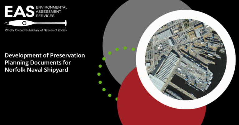
Development of Preservation Planning Documents for Norfolk Naval Shipyard
EAS is developing preservation planning tools to support proposed future construction, rehabilitation and other
Historic Land Use Study and Phase I Archaeological Survey Investigations at Norfolk Naval Shipyard Annexes and Areas, Portsmouth, VA
EAS is preparing a phase I intensive archaeological survey and inventory project at Norfolk